Off-grid on Vargas Island
The Cedar Coast is situated on a 90 acre, waterfront property on the southeast shoreline of Vargas Island, British Columbia. The site is located approximately 5 kilometers Northwest of Tofino.
The property is bordered by mixed rocky and gravel beach shoreline to the East, private forested lands to the South, Keltsmaht First Nation village site to the North and the Vargas Island Provincial Park to the West. Our beach access provides easy and safe entry for swimming, snorkeling, diving, kayaking, and paddle boarding excursions.
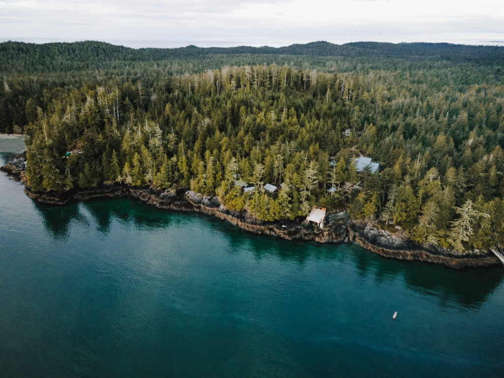
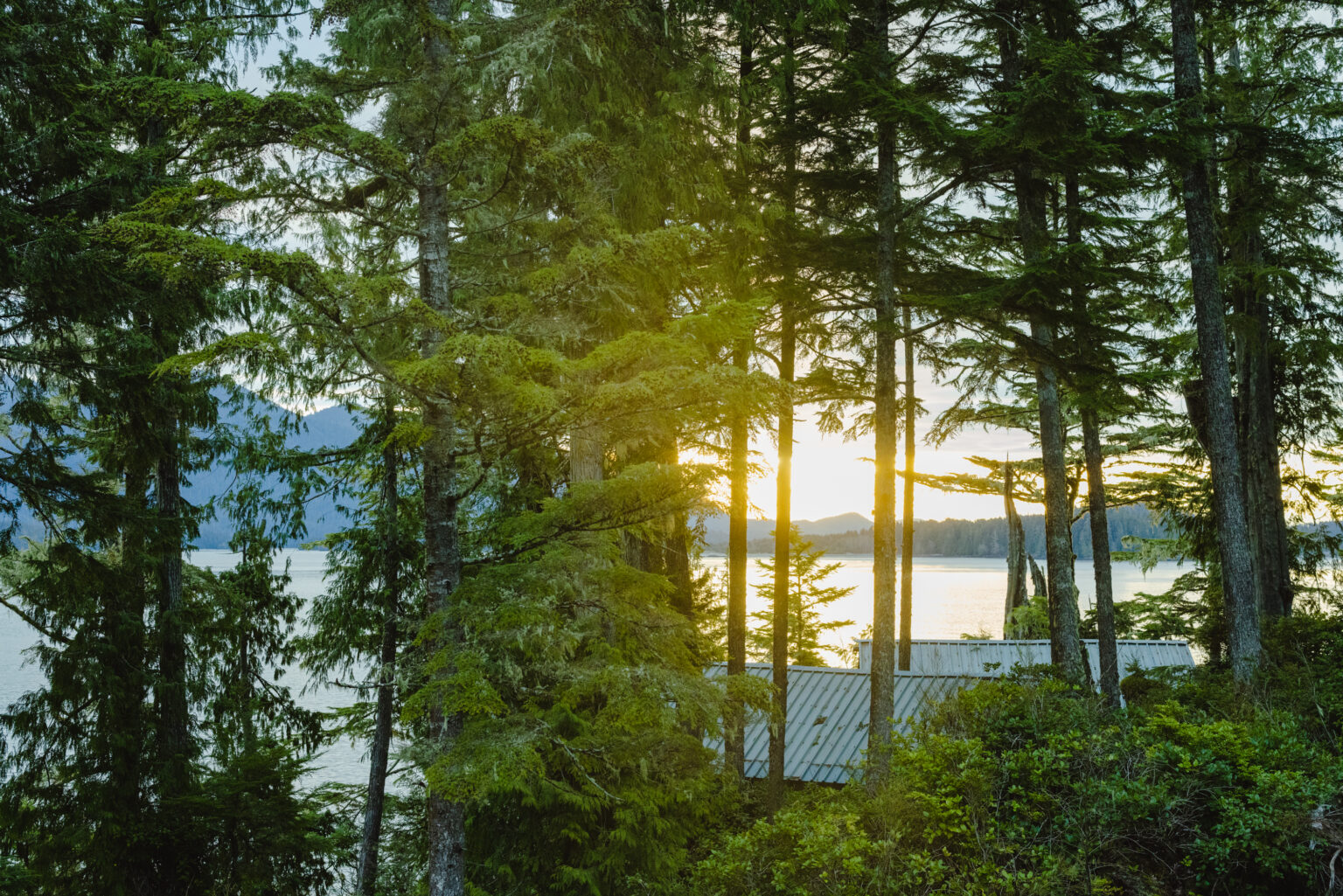
The site contains a mix of new and old-growth forest, predominantly Western Red Cedar (Thuja plicata), Sitka Spruce (Picea sitchensis) and Western Hemlock (Tsuga heterophylla). Below the conifer canopies, Salal (Gaultheria shallon), Salmon Berry (Rubus spectabilis), Evergreen Huckleberry (Vaccinium ovatum), and Deer Fern (Blechnum spicant) make up the dense underbrush.
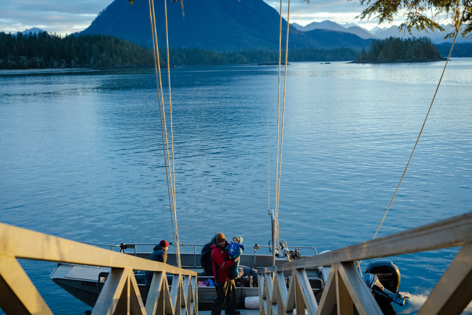
The location provides a fine balance of remoteness and accessibility; far enough away from the noise and lights of Tofino, while still close enough for guests to access many goods and services via a 15-minute boat ride in most weather conditions. In addition, there is a trail directly from Cedar Coast to Ahous Bay on the exposed west side of Vargas Island.
We acknowledge and honour the traditional territories of the Ahousaht, Hesquiaht, and ƛaʔuukʷiʔatḥ (Tla-o-qui-aht) First Nations. In the spirit of truth, healing and reconciliation, Cedar Coast Art and Ecology Centre invites all visitors to join us as respectful guests in this unceded Nuu-chah-nulth Ha’huulthii.
Due to the nature of operating an educational centre from a boat-access-only, coastal island- we are constantly checking the marine forecast. Depending on the time of year and local weather events, it can become impossible to access Vargas Island. Therefore, we do our best to communicate the inherent risk and challenges of planning a trip to Cedar Coast— particularly in our off-season between October 31st and April 1. *Please review our Off-Season Booking Disclaimer prior to booking your trip.
Before heading out on the water, we regularly reference the Government of Canada’s Marine Forecast. All ocean transport provided by Cedar Coast must comply with our Standard Operating Procedures which outline the wind, wave and weather thresholds which are deemed acceptable risk. Please be aware that the Cedar Coast holds the right to reschedule or cancel any planned transport provided by the Cedar Coast due to unfavourable weather conditions. Please review our Refund & Cancellation Policy prior to booking your trip.
The average annual rainfall around the Clayoquot Sound area is 3098 mm, with 2276mm falling between the months of October and March. Rainfall is spread out across the year with >0.2mm of rain on an average of 216 days a year, and >5mm of rain on an average of 130 days a year. (Environment Canada, 2017; Weatherspark, 2016).
On average, 271.7 days per year have measurable “bright sunshine.” 158 of these “bright sunshine” days occurred in the six months from April to September. Annually, 35.7% of possible daylight hours have measurable “bright sunshine,” with the 6 months of April to September averaging 44.1% and the 6 months from October to March averaging 33.27%. The shortest day of the year is December 21st, with 8 hours 12 minutes of daylight and the longest day of the year is June 20th, with 16 hours 13 minutes of daylight (Environment Canada, 2017).
Annual daily average temperature is 9.5˚C, with a high of 13.2˚C and a low of 5.7˚C. The warmest average month is August at 15.0˚C and the coldest month on average is December at 5.0˚C (Environment Canada, 2017).
Wind directions around Clayoquot Sound vary considerably throughout the year. Within the six month period from April to October, the predominant wind directions are South, West and Northwest. Between the months of October and March predominant wind directions tend to be South, Southeast and East. Maximum hourly speeds at Lennard Island (7km south of CCFS) between 1981 and 2010 ranged from 76 km/h to 87 km/h in the months November to April, and 58 km/h to 72 km/h in the months May to October. These maximum wind speeds indicate the worst case scenario in regards to access to Cedar Coast (Environment Canada, 2017; Weatherspark, 2016).